School nearby Shkolla 9-vjeçare Skënder Luarasi
Albania
School nearby Shkolla 9-vjeçare Skënder Luarasi
Shkolla 9-vjeçare Skënder Luarasi
Tirana, Albania
contacts phone
:
+355
Latitude:
41.3459497
, Longitude:
19.7830825
larger map & directions
read more
nearest School
509 m
Shkolla Gjergj Fishta
Rruga Petrit Radovicka, Tirana
School
read more
834 m
Autoshkolla URIM GJURRA
Rruga Arben Broci, Tirana
School
read more
861 m
Aleks Buda
Rruga Gjergj Legisi, Tirana
School
read more
864 m
Gjimnazi Aleks Buda
Tirana
School
read more
945 m
Gjimnazi Isa Boletini
Tirana
School
read more
970 m
Instituti i Artit Kulinar ROYAL
Kashar
School
read more
1.087 km
Shkolla e mesme Isa Boletini
Albanien
School
read more
1.087 km
Shkolla e mesme Isa Boletini
Albania
School
read more
1.088 km
School Gjergj Fishta,Tirana
Rruga Migjeni, Tirana
School
read more
1.167 km
My Friends Center
Rruga Gjergj Legisi, Tirana
School
read more
1.24 km
Shkolla 9 vjeçare Dhori Leka
Tiranë
School
read more
1.241 km
Shkolla Sarina 2002
Tirana
School
read more
1.289 km
Shkolla Ahmet Gashi
Tiranë
School
read more
1.302 km
Memorial International School of Tirana
Mezez, Kashar
School
read more
1.604 km
Shkolla 9-vjeçare Isa-Boletini
Tirana
School
read more
1.635 km
Shkolla Jo Publike Nobel
1050, Kashar
School
read more
1.995 km
Fakulteti i Bujqësisë dhe Mjedisit
Kodër-Kamëz, Tiranë
School
read more
2.031 km
Albanian College Tirana
Rruga Dritan Hoxha 1, Tiranë
School
read more
2.056 km
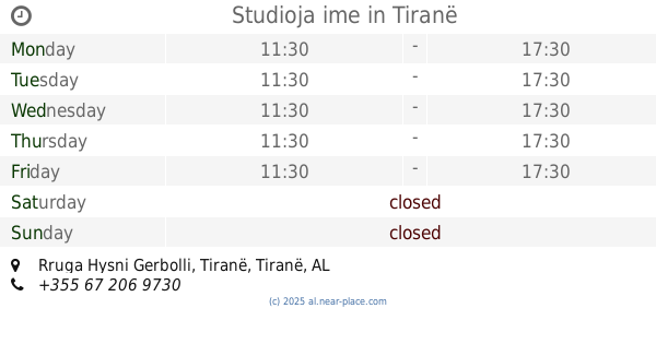
Studioja ime
Rruga Hysni Gerbolli, Tiranë
School
read more
2.057 km
LIVING CENTER(Qendra E Gjuheve Te Huaja )
Tirana
School
read more
2.128 km
SHOQATA ARSİMORE KULTURORE SULEJMANİJE
Kashar
School
read more
2.145 km
Shkolla 'Kole Jakova'
Rruga genc ndreu, Tirana
School
read more
2.273 km
Instituti Profesional ATC
Rruga Asim Vokshi, Tiranë
School
read more
2.453 km
Gjimnazi Qemal Stafa
Rruga e Durrësit, Tirana
School
read more
2.467 km
Instituti i Ndertimit
Rruga Muhamet Gjollesha, Tiranë
School
read more
📑
all categories
Accounting
Administrative area level 1
Administrative area level 2
Airport
Amusement park
Aquarium
Art gallery
Atm
Bakery
Bank
Bar
Beauty salon
Bicycle store
Book store
Bus station
Cafe
Campground
Car dealer
Car rental
Car repair
Car wash
Casino
Cemetery
Church
City hall
Clothing store
Colloquial area
Convenience store
Country
Courthouse
Dentist
Department store
Doctor
Electrician
Electronics store
Embassy
Finance
Fire station
Florist
Food
Funeral home
Furniture store
Gas station
General contractor
Grocery or supermarket
Gym
Hair care
Hardware store
Health
Home goods store
Hospital
Insurance agency
Jewelry store
Laundry
Lawyer
Library
Liquor store
Local government office
Locality
Locksmith
Lodging
Meal delivery
Meal takeaway
Mosque
Movie rental
Movie theater
Moving company
Museum
Natural feature
Neighborhood
Night club
Painter
Park
Parking
Pet store
Pharmacy
Physiotherapist
Place of worship
Plumber
Point of interest
Police
Post office
Premise
Real estate agency
Restaurant
Route
Rv park, camping
School
Shoe store
Shopping mall
Spa
Stadium
Storage
Store
Supermarket
Taxi stand
Train station
Transit station
Travel agency
University
Veterinary care
Zoo
administrative area level 3
administrative area level 5
sublocality level 1
↑