School nearby Kopshti Numani
Albania
School nearby Kopshti Numani
Kopshti Numani
Rruga Bilal Golemi, Tirana, Tirana, AL Albania
contacts phone
:
+355
Latitude:
41.3157295
, Longitude:
19.8085561
larger map & directions
read more
nearest School
398 m
DRITA E DIJES
Rruga Bilal Xhaferri, Tirana
School
read more
493 m
Instituti i Eksperteve Fiskale
Rruga Ymer Kurti, Tirana
School
read more
520 m
Shkolla "At Zef Pllumi"
Tirana
School
read more
576 m
Fakulteti Inxhinierisë Matematike&Fizike
Tirana
School
read more
579 m
Gjimnazi Petro Nini Luarasi
Rruga Sami Frashëri, Tirana
School
read more
579 m
Petro Nini Luarasi
Rruga Sami Frashëri, Tirana
School
read more
596 m
Qender Kursesh Eureka
Tirana
School
read more
659 m
Shkolla 9 Vjecare Vasil Shanto
Tirana
School
read more
680 m
Shkolla Vasil Shanto
Tirana
School
read more
691 m
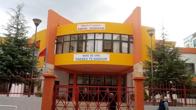
Shkolla 9 vjeçare publike Edith Durham
Rruga Pjetër Bogdani, Tiranë
School
read more
704 m
Instituti i Projekteve Arsimore
Rruga Perlat Rexhepi, Tiranë
School
read more
727 m
Kopshti Nr.42
Rruga Nikolla Tupe, Tiranë
School
read more
745 m
ASPA
Bulevardi Gjergj Fishta, Tirana
School
read more
754 m
fakultet i xhinerise matematike dhe fizike
Tirana
School
read more
770 m
DRFPP 4
Tirana
School
read more
793 m
Pjeter Budi
Tirana
School
read more
810 m
Kopshti Nr 31
Tirana
School
read more
849 m
English Cultural Centre
Rruga Vaso Pasha, Tiranë
School
read more
896 m
Abraham Lincoln Center
Number 184, Tiranë
School
read more
905 m
kindergarten nr. 17
Tirana
School
read more
917 m
Gauss
Tirana
School
read more
988 m
Kopshti 4 Stinet
Tirana
School
read more
1.082 km
Shkolla Sabaudin Gabrani
Rruga Myslym Shyri 91, Tiranë
School
read more
1.151 km
Shkolla Dora D'Istria
Rruga Astrit Sulejman Balluku 3, Tirana
School
read more
1.192 km
Autoshkolla KLAVIN
Rruga Reshit Çollaku 4
School
read more
📑
all categories
Accounting
Administrative area level 1
Administrative area level 2
Airport
Amusement park
Aquarium
Art gallery
Atm
Bakery
Bank
Bar
Beauty salon
Bicycle store
Book store
Bus station
Cafe
Campground
Car dealer
Car rental
Car repair
Car wash
Casino
Cemetery
Church
City hall
Clothing store
Colloquial area
Convenience store
Country
Courthouse
Dentist
Department store
Doctor
Electrician
Electronics store
Embassy
Finance
Fire station
Florist
Food
Funeral home
Furniture store
Gas station
General contractor
Grocery or supermarket
Gym
Hair care
Hardware store
Health
Home goods store
Hospital
Insurance agency
Jewelry store
Laundry
Lawyer
Library
Liquor store
Local government office
Locality
Locksmith
Lodging
Meal delivery
Meal takeaway
Mosque
Movie rental
Movie theater
Moving company
Museum
Natural feature
Neighborhood
Night club
Painter
Park
Parking
Pet store
Pharmacy
Physiotherapist
Place of worship
Plumber
Point of interest
Police
Post office
Premise
Real estate agency
Restaurant
Route
Rv park, camping
School
Shoe store
Shopping mall
Spa
Stadium
Storage
Store
Supermarket
Taxi stand
Train station
Transit station
Travel agency
University
Veterinary care
Zoo
administrative area level 3
administrative area level 5
sublocality level 1
↑