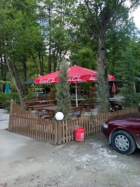
Restaurant nearby XHILI
Albania
Restaurant nearby XHILI
XHILI
SH64, Drilon, Rrethi i Pogradecit, AL Albania
contacts phone
:
+355 69 217 5602
Latitude:
40.9016188
, Longitude:
20.7136899
larger map & directions
read more
nearest Restaurant
41 m
Taverna Agae
SH64, Drilon
Restaurant
read more
45 m
Restorant Piceri Dante.
SH64, Rruga Nacionale - Dogana Tushemisht, Tushemisht, Pograde, Albania EU
Restaurant
read more
74 m
Restorant Kristal
SH64, Drilon
Restaurant
read more
121 m
Vila ART
Rruga NACIONALE Pogradec, Tushemisht
Restaurant
read more
190 m
Bar Restorant EGNIS
Drilon.Rruga NacionalePogradec
Restaurant
read more
217 m
Pogradec New Titanic
RrugaDrilon
Restaurant
read more
272 m
Pogradec Restorant Mjelma
Drilon
Restaurant
read more
323 m
Camping ARBI
Drilon tushemisht, pogradec albania
Restaurant
read more
360 m
Vila 31
Tushemisht
Restaurant
read more
450 m
Sunset Hotel
SH64, Drilon
Restaurant
read more
463 m
Elvis Restaurant
Tushemisht
Restaurant
read more
570 m
La Marena
Tushemisht
Restaurant
read more
590 m
BAR RESTORANT GJOLI
Tushemisht
Restaurant
read more
591 m
Bujtina Alpine
Tushemisht
Restaurant
read more
609 m
Restorant Kashta
SH64, Tushemisht
Restaurant
read more
621 m
Taverna KOÇO
Tushemisht
Restaurant
read more
624 m
Dallga
SH64, Tushemisht
Restaurant
read more
676 m
Rritja e Koranit
Tushemisht, Pogradec, Albania, SH64, Tushemisht
Restaurant
read more
731 m
Restorant Korca
SH64, Tushemisht
Restaurant
read more
1.317 km
Bar Restorant Camping Fabio
Rruga e Drilonit, Pogradec
Restaurant
read more
2.811 km
Ostrovo
Свети Наум,Охрид - Saint Naum,Ohrid
Restaurant
read more
2.852 km
Cuba Libre
Restaurant
read more
3.104 km
Sveti Naum
St. Naum, Saint Naum, Bitola
Restaurant
read more
3.864 km
Zgara te Glenti
Pogradec
Restaurant
read more
4.48 km
Corner Bar & Grill
Pogradec
Restaurant
read more
📑
all categories
Accounting
Administrative area level 1
Administrative area level 2
Airport
Amusement park
Aquarium
Art gallery
Atm
Bakery
Bank
Bar
Beauty salon
Bicycle store
Book store
Bus station
Cafe
Campground
Car dealer
Car rental
Car repair
Car wash
Casino
Cemetery
Church
City hall
Clothing store
Colloquial area
Convenience store
Country
Courthouse
Dentist
Department store
Doctor
Electrician
Electronics store
Embassy
Finance
Fire station
Florist
Food
Funeral home
Furniture store
Gas station
General contractor
Grocery or supermarket
Gym
Hair care
Hardware store
Health
Home goods store
Hospital
Insurance agency
Jewelry store
Laundry
Lawyer
Library
Liquor store
Local government office
Locality
Locksmith
Lodging
Meal delivery
Meal takeaway
Mosque
Movie rental
Movie theater
Moving company
Museum
Natural feature
Neighborhood
Night club
Painter
Park
Parking
Pet store
Pharmacy
Physiotherapist
Place of worship
Plumber
Point of interest
Police
Post office
Premise
Real estate agency
Restaurant
Route
Rv park, camping
School
Shoe store
Shopping mall
Spa
Stadium
Storage
Store
Supermarket
Taxi stand
Train station
Transit station
Travel agency
University
Veterinary care
Zoo
administrative area level 3
administrative area level 5
sublocality level 1
↑