Restaurant nearby Turizmi Restaurant
Albania
Restaurant nearby Turizmi Restaurant
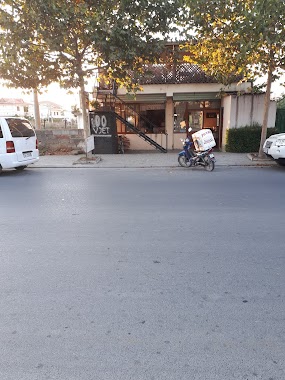
Turizmi Restaurant
Burrel Albania
contacts phone
:
+355
Latitude:
41.6103984
, Longitude:
20.0133475
read more
nearest Restaurant
137 m
N'Bahce
Sheshi Ahmet Zogu, Burrel Mat
Restaurant
read more
386 m
TARZANI Bar Restaurant
Burrel
Restaurant
read more
4.183 km
Restorant Vëllezërit Molla
Komsi
Restaurant
read more
20.379 km
Sari Salltik
Krujë District
Restaurant
read more
20.721 km
Mira Restorant dasmash
Rruga e Arbërit, Bulqizë
Restaurant
read more
21.443 km
Bar Restorant Piceri ALBA
Castle of Kruja Krujë District
Restaurant
read more
21.532 km
Bar Restorant Piceri ALBA
Krujë District
Restaurant
read more
22.211 km
Pizzeria ReyBela
1501,, Krujë
Restaurant
read more
23.169 km
Bar Restoran
Krujë District
Restaurant
read more
24.418 km
Lokali i Fadilit
Rruga Hysen Dani, Gjonëm
Restaurant
read more
24.978 km
Byrek Shyqi
Rruga Kurbini, Laç
Restaurant
read more
25.004 km
Hotel Bar Restaurant Stone
Albania
Restaurant
read more
26.337 km
Europa
Rubik
Restaurant
read more
27.742 km
Bar Restorant Vathi
Rruga e Krujes, Fushë-Kruje
Restaurant
read more
27.893 km
Restorant Redi
Fushë-Krujë
Restaurant
read more
27.946 km
Bar Restorant BABAJ
Fushë-Krujë, Albania Fushë
Restaurant
read more
28.253 km
Voila Slow Food
Fushë-Krujë
Restaurant
read more
28.297 km
Fast Food TE NORI
Fushë-Krujë
Restaurant
read more
28.924 km
Kompleksi Zaja
Larushk
Restaurant
read more
30.684 km
Familja Frang Pjetri
Rruga e Xhamise, Kukës
Restaurant
read more
30.974 km
Klajdi Park
Kreis Kruja
Restaurant
read more
31.922 km
Restorant Shpresa
SH1
Restaurant
read more
32.222 km
Piceri Gentjana
Rruga Berisha, Kamëz
Restaurant
read more
32.789 km
Piazza Airport Bar Restaurant
Airport Road, Tiranë
Restaurant
read more
33.326 km
Polikron Metalia
Rruga Kujtesa, Kamëz
Restaurant
read more
📑
all categories
Accounting
Administrative area level 1
Administrative area level 2
Airport
Amusement park
Aquarium
Art gallery
Atm
Bakery
Bank
Bar
Beauty salon
Bicycle store
Book store
Bus station
Cafe
Campground
Car dealer
Car rental
Car repair
Car wash
Casino
Cemetery
Church
City hall
Clothing store
Colloquial area
Convenience store
Country
Courthouse
Dentist
Department store
Doctor
Electrician
Electronics store
Embassy
Finance
Fire station
Florist
Food
Funeral home
Furniture store
Gas station
General contractor
Grocery or supermarket
Gym
Hair care
Hardware store
Health
Home goods store
Hospital
Insurance agency
Jewelry store
Laundry
Lawyer
Library
Liquor store
Local government office
Locality
Locksmith
Lodging
Meal delivery
Meal takeaway
Mosque
Movie rental
Movie theater
Moving company
Museum
Natural feature
Neighborhood
Night club
Painter
Park
Parking
Pet store
Pharmacy
Physiotherapist
Place of worship
Plumber
Point of interest
Police
Post office
Premise
Real estate agency
Restaurant
Route
Rv park, camping
School
Shoe store
Shopping mall
Spa
Stadium
Storage
Store
Supermarket
Taxi stand
Train station
Transit station
Travel agency
University
Veterinary care
Zoo
administrative area level 3
administrative area level 5
sublocality level 1
↑