Natural feature nearby Liqeni i Krujës
Albania
Natural feature nearby Liqeni i Krujës
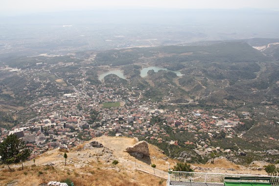
Liqeni i Krujës
Liqeni i Krujës, Albanien
contacts phone
:
+355
Latitude:
41.5123361
, Longitude:
19.736473
larger map & directions
read more
nearest Natural feature
2.247 km
Maja e Picrrages
Krujë District
Natural feature
read more
2.247 km
Maja e Picrrages
Kreis Kruja
Natural feature
read more
2.247 km
Maja e Picrrages
Krujë
Natural feature
read more
2.247 km
Maja e Picrrages
Distrito de Krujë
Natural feature
read more
2.329 km
Mali i Picrrages
Okręg Kruja
Natural feature
read more
2.329 km
Mali i Picrrages
Krujë District
Natural feature
read more
2.329 km
Mali i Picrrages
Distrito de Krujë
Natural feature
read more
3.097 km
Liqeni i Baruneve
Krujë
Natural feature
read more
4.125 km
Liqeni i Borizanes
Albanien
Natural feature
read more
4.125 km
Liqeni i Borizanes
Albania
Natural feature
read more
5.011 km
Liqeni i Kamersit
Albania
Natural feature
read more
5.112 km
Kole-Bardhe
Krujë
Natural feature
read more
5.704 km
Maja e Rakshanit
Okręg Kruja
Natural feature
read more
5.704 km
Maja e Rakshanit
Krujë District
Natural feature
read more
5.704 km
Maja e Rakshanit
Distrito de Krujë
Natural feature
read more
6.196 km
Liqeni i Thumanes
Albania
Natural feature
read more
6.247 km
Pylli i Zgerdheshit
Albania
Natural feature
read more
6.291 km
Gryka e Vajës
Albanien
Natural feature
read more
8.938 km
Maja e Pocit
Albania
Natural feature
read more
10.653 km
Liqeni i bubqit
Albania
Natural feature
read more
11.405 km
Mali i Skenderbeut
Albania
Natural feature
read more
11.867 km
Liqeni
Albania
Natural feature
read more
14.685 km
Kodra Llonit
Manëza e Re (kucok)
Natural feature
read more
18.136 km
Ujembledhesi i Rubjekes
Albanien
Natural feature
read more
18.195 km
Maja e Shpatës
Albania
Natural feature
read more
📑
all categories
Accounting
Administrative area level 1
Administrative area level 2
Airport
Amusement park
Aquarium
Art gallery
Atm
Bakery
Bank
Bar
Beauty salon
Bicycle store
Book store
Bus station
Cafe
Campground
Car dealer
Car rental
Car repair
Car wash
Casino
Cemetery
Church
City hall
Clothing store
Colloquial area
Convenience store
Country
Courthouse
Dentist
Department store
Doctor
Electrician
Electronics store
Embassy
Finance
Fire station
Florist
Food
Funeral home
Furniture store
Gas station
General contractor
Grocery or supermarket
Gym
Hair care
Hardware store
Health
Home goods store
Hospital
Insurance agency
Jewelry store
Laundry
Lawyer
Library
Liquor store
Local government office
Locality
Locksmith
Lodging
Meal delivery
Meal takeaway
Mosque
Movie rental
Movie theater
Moving company
Museum
Natural feature
Neighborhood
Night club
Painter
Park
Parking
Pet store
Pharmacy
Physiotherapist
Place of worship
Plumber
Point of interest
Police
Post office
Premise
Real estate agency
Restaurant
Route
Rv park, camping
School
Shoe store
Shopping mall
Spa
Stadium
Storage
Store
Supermarket
Taxi stand
Train station
Transit station
Travel agency
University
Veterinary care
Zoo
administrative area level 3
administrative area level 5
sublocality level 1
↑