Museum nearby Armed Forces Museum
Albania
Museum nearby Armed Forces Museum
Armed Forces Museum
Tirana, Albania
contacts phone
:
+355
website:
www.mod.gov.al
Latitude:
41.3416238
, Longitude:
19.8386051
larger map & directions
read more
nearest Museum
1.082 km
Art Galeri Kaceli
Rruga 4 Dëshmorët, Tirana
Museum
read more
1.654 km
Sali Shijaku House
Rruga Vildan Luarasi, Tiranë
Museum
read more
1.754 km
Momumet Of Vojo Kushi
Rruga Mahmut Fortuzi, Tiranë
Museum
read more
1.81 km
Muzeu I Shkencave Natyrore
Rruga Petro Nini Luarasi, Tiranë
Museum
read more
2.094 km
Tyrbja e Kapllan Pashes
Tirana
Museum
read more
2.162 km
Pllakë përkujtimore në nderim të János Hunyadit
Tirana
Museum
read more
2.224 km
Clocks' Museum
Rruga 28 Nëntori, Tirana
Museum
read more
2.229 km
National History Museum
Sheshi Skënderbej 1, Tirana
Museum
read more
2.254 km
Shtëpia Muze e familjes Toptani
E852, Tiranë
Museum
read more
2.293 km
Bunk'Art 2
Rruga Sermedin Said Toptani, Tiranë
Museum
read more
2.397 km
Muzeu i Bankës së Shqipërisë
Sheshi Skënderbej 1, Tirana
Museum
read more
2.486 km
House of Leaves
Tirana
Museum
read more
2.487 km
House Of Leaves
Rruga Deshmoret e 4 Shkurtit, Tirana
Museum
read more
2.492 km
Mezuraj Museum
Rruga e Kavajës, Tiranë
Museum
read more
2.755 km
Trojet Foundation Trojet Collections
Tirana
Museum
read more
2.911 km
Museum Of Natural Sciences
Rruga Mujo Ulqinaku 5, Tiranë
Museum
read more
2.935 km
National Archaeological Museum
Sheshi Nënë Tereza, Tiranë
Museum
read more
2.969 km
Q.M.K.SH.
Tirana
Museum
read more
3.108 km
Tuneli Me Zemera
Rruga Abdyl Frashëri 2
Museum
read more
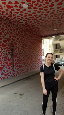
3.108 km
Heart Tunnel
Rruga Abdyl Frashëri 2
Museum
read more
3.198 km
Muzeu i Shkencave Natyrore
Rruga e Kavajës, Tiranë
Museum
read more
3.929 km
YeReBlu ART Studio
Tirana
Museum
read more
4.122 km
Studio Arti
Rruga Gaqo Avrazi, Tiranë
Museum
read more
13.978 km
Xhamia Nikël
Rruga për Nikël, Nikël
Museum
read more
18.417 km
Qttb Fushe Kruje
SH52, Vorë
Museum
read more
📑
all categories
Accounting
Administrative area level 1
Administrative area level 2
Airport
Amusement park
Aquarium
Art gallery
Atm
Bakery
Bank
Bar
Beauty salon
Bicycle store
Book store
Bus station
Cafe
Campground
Car dealer
Car rental
Car repair
Car wash
Casino
Cemetery
Church
City hall
Clothing store
Colloquial area
Convenience store
Country
Courthouse
Dentist
Department store
Doctor
Electrician
Electronics store
Embassy
Finance
Fire station
Florist
Food
Funeral home
Furniture store
Gas station
General contractor
Grocery or supermarket
Gym
Hair care
Hardware store
Health
Home goods store
Hospital
Insurance agency
Jewelry store
Laundry
Lawyer
Library
Liquor store
Local government office
Locality
Locksmith
Lodging
Meal delivery
Meal takeaway
Mosque
Movie rental
Movie theater
Moving company
Museum
Natural feature
Neighborhood
Night club
Painter
Park
Parking
Pet store
Pharmacy
Physiotherapist
Place of worship
Plumber
Point of interest
Police
Post office
Premise
Real estate agency
Restaurant
Route
Rv park, camping
School
Shoe store
Shopping mall
Spa
Stadium
Storage
Store
Supermarket
Taxi stand
Train station
Transit station
Travel agency
University
Veterinary care
Zoo
administrative area level 3
administrative area level 5
sublocality level 1
↑