Church nearby Shen Thanasi
Albania
Church nearby Shen Thanasi
Shen Thanasi
Rruga Çlirimi i Korçës, Korçë District, Korçë County, AL Albania
contacts phone
:
+355
Latitude:
40.6165875
, Longitude:
20.7889713
larger map & directions
read more
nearest Church
505 m
Shen Maria
Bulevardi Fan Noli, Korçë
Church
read more
515 m
Mitropolia
Rruga Sotir Peçi, Korçë
Church
read more
577 m
Kisha Shen Anna
Rruga Avni Rustemi, Korçë
Church
read more
701 m
Katedralja Ortodokse
Korçë
Church
read more
701 m
Katedralja Ortodokse
Korça
Church
read more
701 m
Katedralja Orthodhokse Ringjallja e Krishtit
Bulevardi Shën Gjergji, Korçë
Church
read more
706 m
Korcha Evangelical Church
Rruga Niko Dodona 10, Korçë
Church
read more
840 m
Shën Ilia
Rruga Lola Gjoka
Church
read more
909 m
Ish Kisha E Shen Gjergjit
Korçë
Church
read more
939 m
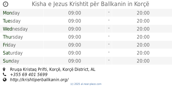
Kisha e Jezus Krishtit për Ballkanin
L. 15, Rruga Kristaq Prifti, Korçë
Church
read more
1.017 km
Kisha Vllahe
Bulevardi Rilindasit, Korçë
Church
read more
1.043 km
Kisha Misioni Emanuel - Mission Emanuel Foursquare Church
Rr. vangel ballta "zakaraj" kat. 1
Church
read more
1.066 km
KORÇA SDA Church
Rruga Doktor Sotir Polena, Korçë
Church
read more
1.152 km
Kisha e Krishtit Korce
Rruga 28 Nëntori, Korçë
Church
read more
1.307 km
Shen Thodher
Church
read more
1.314 km
Shen Triadha
Korçë
Church
read more
1.781 km
Kisha Shen Ristozi
Mborje
Church
read more
1.781 km
Church of Christ's Ascension, Mborja, Korça
Mborje
Church
read more
2.21 km
Shën Ilia
Albania
Church
read more
2.21 km
Shën Ilia
Albanien
Church
read more
3.529 km
Shën Thomai
Çiflig
Church
read more
3.703 km
Shen Maria
Drenovë Municipality
Church
read more
10.023 km
Shen Nikolla (Satrivaç)
Rruga Hoçisht - Bilisht, Hoçisht
Church
read more
10.263 km
Shen Ilia
Hoçisht
Church
read more
11.314 km
Kisha e Shen Jovanit
Hoçisht
Church
read more
📑
all categories
Accounting
Administrative area level 1
Administrative area level 2
Airport
Amusement park
Aquarium
Art gallery
Atm
Bakery
Bank
Bar
Beauty salon
Bicycle store
Book store
Bus station
Cafe
Campground
Car dealer
Car rental
Car repair
Car wash
Casino
Cemetery
Church
City hall
Clothing store
Colloquial area
Convenience store
Country
Courthouse
Dentist
Department store
Doctor
Electrician
Electronics store
Embassy
Finance
Fire station
Florist
Food
Funeral home
Furniture store
Gas station
General contractor
Grocery or supermarket
Gym
Hair care
Hardware store
Health
Home goods store
Hospital
Insurance agency
Jewelry store
Laundry
Lawyer
Library
Liquor store
Local government office
Locality
Locksmith
Lodging
Meal delivery
Meal takeaway
Mosque
Movie rental
Movie theater
Moving company
Museum
Natural feature
Neighborhood
Night club
Painter
Park
Parking
Pet store
Pharmacy
Physiotherapist
Place of worship
Plumber
Point of interest
Police
Post office
Premise
Real estate agency
Restaurant
Route
Rv park, camping
School
Shoe store
Shopping mall
Spa
Stadium
Storage
Store
Supermarket
Taxi stand
Train station
Transit station
Travel agency
University
Veterinary care
Zoo
administrative area level 3
administrative area level 5
sublocality level 1
↑