Bakery nearby Elinikon Pasticeri
Albania
Bakery nearby Elinikon Pasticeri
Elinikon Pasticeri
Tirana, Albania
contacts phone
:
+355
Latitude:
41.3230342
, Longitude:
19.7945973
larger map & directions
read more
nearest Bakery
227 m
ZAIMI Pasticeri
Ndre Mjeda Street, 166/1, Tiranë
Bakery
read more
358 m
Furrë Buke Pastiçeri 'Losha'
Rruga Irfan Tomini, Tiranë
Bakery
read more
379 m
Furre buke speciale
Rruga Irfan Tomini, Tiranë
Bakery
read more
388 m
Pasticeri Eleni
Tirana
Bakery
read more
484 m
Furre Buke Geraj
Tirana
Bakery
read more
514 m
Dumrea Furre Buke Pasticeri
Bulevardi Bajram Curri, Tiranë
Bakery
read more
542 m
Furre Buke Shenjatari
Rruga Isuf Elezi 1022, Tirana
Bakery
read more
554 m
Furrë Buke Sulaj
Tirana
Bakery
read more
569 m
Furre buke pastiqeri sulaj
Rruga e Kavajës, Tiranë
Bakery
read more
621 m
Furre buke LOSMAR
Isuf elezi, Tirane
Bakery
read more
708 m
Furre buke pasticeri 21
Rruga e Kavajës, Tiranë
Bakery
read more
865 m
Someg
Tirana
Bakery
read more
1.125 km
Elinikon Bakery
Tirana
Bakery
read more
1.133 km
Pasticeri & Furre Buke NELA
Rruga Teodor Keko, Unaze e re, Tirane, Tiranë
Bakery
read more
1.137 km
Furre Buke Mesiti
Yzberisht, Kashar
Bakery
read more
1.241 km
Furra Mjeshtria
Tirana
Bakery
read more
1.258 km
Nefeli
Rruga Medar Shtylla, Tirana
Bakery
read more
1.275 km
Byrektore Leta
Tirana
Bakery
read more
1.294 km
Byrektore Avdyli
Tirana
Bakery
read more
1.3 km
Furre Buke
Ngjitur me Pallatin e Alpha Bank, Rruga Aleksandri i Madh, Tiranë
Bakery
read more
1.34 km
Byrektore Te Cunat
Tirana
Bakery
read more
1.478 km
Furrë Buke Noel
Rruga e Kavajës, Tiranë
Bakery
read more
1.518 km
Furre Pasticeri Shinjatari
Rruga Mikel Maruli, Tiranë
Bakery
read more
1.558 km
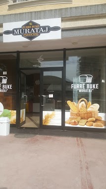
Furre Buke MURATAJ
Rruga Pandi Dardha Tirana 1025, Rruga Pandi Dardha, Tirana
Bakery
read more
1.701 km
Gruri i Arte
Don Bosco, Tirana
Bakery
read more
📑
all categories
Accounting
Administrative area level 1
Administrative area level 2
Airport
Amusement park
Aquarium
Art gallery
Atm
Bakery
Bank
Bar
Beauty salon
Bicycle store
Book store
Bus station
Cafe
Campground
Car dealer
Car rental
Car repair
Car wash
Casino
Cemetery
Church
City hall
Clothing store
Colloquial area
Convenience store
Country
Courthouse
Dentist
Department store
Doctor
Electrician
Electronics store
Embassy
Finance
Fire station
Florist
Food
Funeral home
Furniture store
Gas station
General contractor
Grocery or supermarket
Gym
Hair care
Hardware store
Health
Home goods store
Hospital
Insurance agency
Jewelry store
Laundry
Lawyer
Library
Liquor store
Local government office
Locality
Locksmith
Lodging
Meal delivery
Meal takeaway
Mosque
Movie rental
Movie theater
Moving company
Museum
Natural feature
Neighborhood
Night club
Painter
Park
Parking
Pet store
Pharmacy
Physiotherapist
Place of worship
Plumber
Point of interest
Police
Post office
Premise
Real estate agency
Restaurant
Route
Rv park, camping
School
Shoe store
Shopping mall
Spa
Stadium
Storage
Store
Supermarket
Taxi stand
Train station
Transit station
Travel agency
University
Veterinary care
Zoo
administrative area level 3
administrative area level 5
sublocality level 1
↑